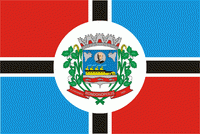
Map - Rondonópolis

Rondonópolis
Rondonópolis (formerly known as Rio Vermelho (Red River)) is the third-largest municipality in Mato Grosso, Brazil. It is located around 215 km from Cuiabá, the capital of the state. The city is named for military officer and explorer Cândido Rondon.

The municipality contains the 6422 ha Dom Osório Stoffel State Park, created in 2002. The Vermelho River runs through the south of the municipal seat and along the north of the state park border.

 
Map - Rondonópolis
Map
Google Earth - Map - Rondonópolis
Google Earth
Openstreetmap - Map - Rondonópolis
Openstreetmap
Map - Rondonópolis - Esri.WorldImagery
Esri.WorldImagery
Map - Rondonópolis - Esri.WorldStreetMap
Esri.WorldStreetMap
Map - Rondonópolis - OpenStreetMap.Mapnik
OpenStreetMap.Mapnik
Map - Rondonópolis - OpenStreetMap.HOT
OpenStreetMap.HOT
Map - Rondonópolis - OpenTopoMap
OpenTopoMap
Map - Rondonópolis - CartoDB.Positron
CartoDB.Positron
Map - Rondonópolis - CartoDB.Voyager
CartoDB.Voyager
Map - Rondonópolis - OpenMapSurfer.Roads
OpenMapSurfer.Roads
Map - Rondonópolis - Esri.WorldTopoMap
Esri.WorldTopoMap
Map - Rondonópolis - Stamen.TonerLite
Stamen.TonerLite
Country - Brazil
Currency / Language  
ISO Currency Symbol Significant figures
BRL Brazilian real R$ 2
Neighbourhood - Country  
  •  Argentina 
  •  Bolivia 
  •  Colombia 
  •  French Guiana 
  •  Guyana 
  •  Paraguay 
  •  Peru 
  •  Suriname 
  •  Uruguay 
  •  Venezuela 
Administrative Subdivision
City, Village,...